Some recollections of Hala Road, Scotforth,
in the early years of the 20th century,
as related by Evelyn (nee) Rushton.
(with explanatory reference notes expanding on Evelyn’s information.)
By Alan Passmore.
— V 3. —
Preface.
My aunt Mrs Evelyn Duckworth (nee Rushton), my mother’s younger sister, was born in 1905 at Friends’ Farm in Hala Road, Scotforth, daughter of Samuel Rushton and Alice Green; the eldest of the three children was their brother James. Eve and my mother Lilian were particularly close and consequently we saw a lot of each other. I was very impressed by her ability in old age to recall details of the past, particularly about the area in which she was brought up and the folk who populated it; in my own young days this locality was not much different physically from how it had been in hers, though there has been much change since. Evelyn attended Lancaster Girls’ Grammar School during and after the Great War and in 1928 was one of the first women to graduate in chemistry from Manchester University; before marrying she worked for five years for the Nobel company at Ardeer, Scotland. From 1951 she and her family lived in Morecambe. She remained in close contact with the University’s alumni group for the rest of her life, for many years as their secretary.
In the late 1990s I sat down with her and asked her to describe what the area was like in her young days, while she was still at school, and who lived there. We had the assistance of an old local trades directory for reference, though this was from a few years earlier – 1901, I think. Many of the houses in Hala Road had been built in the 1870s by our relative Matthew Hall, who lived at No 20, to provide accommodation for the workers he employed in his market garden business and for other tenants too. Since our discussion took place, the 1901 and 1911 censuses have become available for public consultation as additional reference points, so these are quoted in the notes I have provided; the 1939 population register has also since been made available for consultation. We have, therefore, been able to re-populate the area with the families briefly described in the notes.
My aunt died in 2006 at the age of 100, still very much of sound mind.
Alan Passmore, Parkgate, Wirral, Cheshire.
February 2020
Introduction
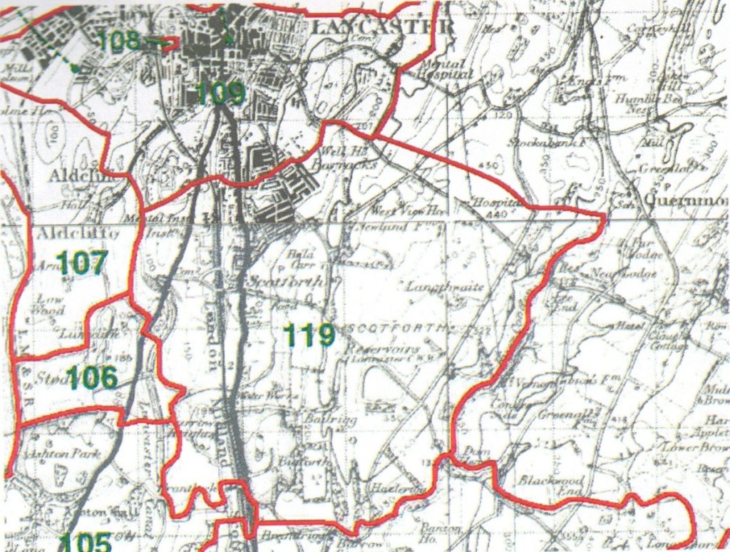
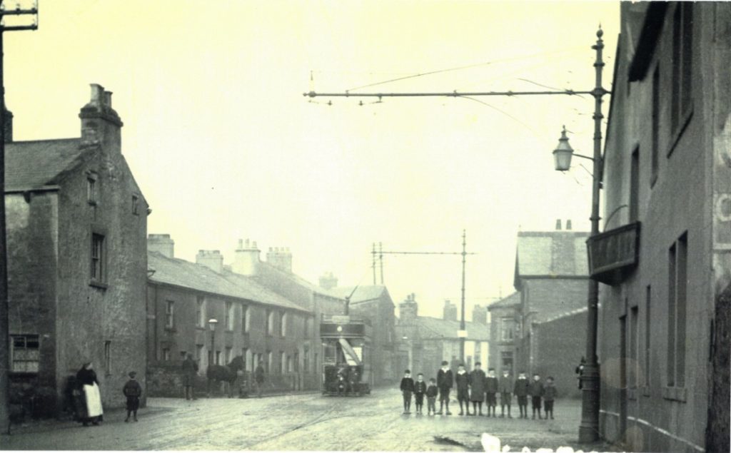
In the early years of the century our family, the Rushtons, lived at Friends Farm in Hala Road, Scotforth. Before Scotforth 1 became part of Lancaster in 1901, it was quite a separate little village centred around the two small squares (Hala and Scotforth) either side of the main road, where from 1902 the trams from Lancaster terminated; it was also, however, quite an extensive parish (see area 119 below), stretching from Bailrigg in the south almost as far north as ‘The Pointer’, where South Road meets Greaves Road and Bowerham Road at a recently constructed roundabout. This is where the Lancaster town boundary was then situated; there was even a short street there called Boundary Road in recognition of this fact.
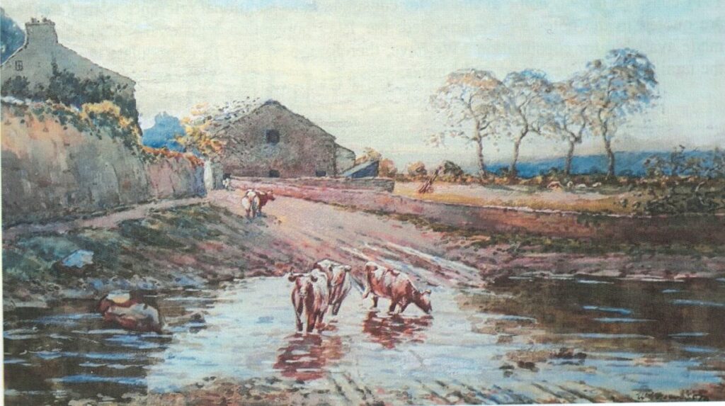
Scotforth lay on the old turnpike road from Lancaster to Preston, the main west coast route between England and Scotland, now the busy A6. The name of the area appears to have derived from the stationing there in 1745 of Scottish troops during one of the Jacobite rebellions in the eighteenth century – that of Bonnie Prince Charlie – around here there was some sympathy for the Jacobite cause. The origins of the name, however, lie much further back in history; a dispute over the ownership of land in the township of Scotforth was settled by court as long ago as 1292. The main road was still referred to as the turnpike in my childhood, and there was a toll house on the southern edge of the village opposite Hala Grove; it stood there until relatively recent times, but it was eventually demolished to facilitate the widening of the road, and what was left of the site now forms part of the forecourt of what for many years was Rogerson’s garage. Despite the importance of this road in the national network there was then remarkably little traffic on it, as contemporary photographs show.
The records show that at the very start of this century Hala Road, which met the main A6 road at Hala Square, was known as East Road, Scotforth, whereas Ashford Road on the other side of the A6 was formerly West Road, Scotforth 2; these names were changed in or after 1901, when this part of Scotforth was incorporated into the municipal borough of Lancaster, in order to avoid confusion with other streets in the town with these names.
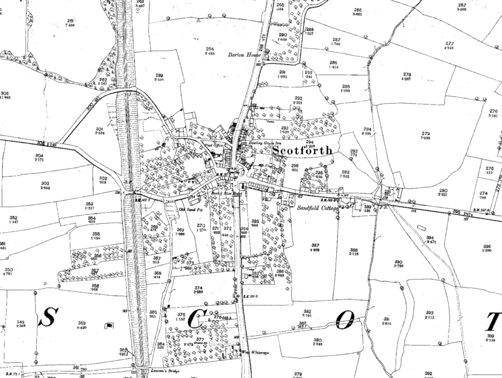
This OS map of 1891 shows the extent of Scotforth village at that time, centred on the crossroads, with some of the main landmarks identified: the Bowling Green Inn and Post Office in North Road, the Boot & Shoe Hotel and Smithy opposite each other in South Road, and Sandfield Cottage in East Road. The dark line marks the post-1901 Lancaster town boundary following the Scotforth Brook. Friends Farm is situated amongst the small group of buildings on the north side of East (Hala) Road, opposite the words ‘Sandfield Cottage’. What appears to be a short terrace of three houses set back from the road appears to stand where Brookdale was later built in 1903. Apart from this, there would be little change over the next two decades in the period up to the time when Eve began to observe the scene.
__________
1 It was just the northern part of the civil parish, which included the nucleus of the village, which was added to the borough of Lancaster at this time: the residue remained part of the Lancaster Rural District. Lancaster only became a city in 1937.
2There were also North Road and South Road, these now Scotforth Road; in the 1891 census and previously the individual roads were parcelled together and referred to simply as Scotforth Village or The Village.
Lets go to Friends Farm.